
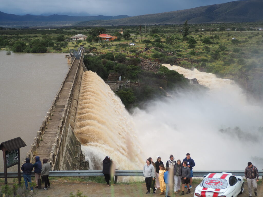
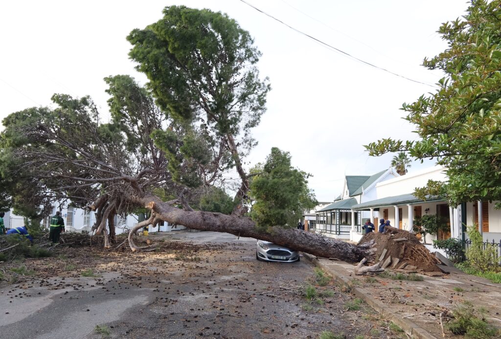
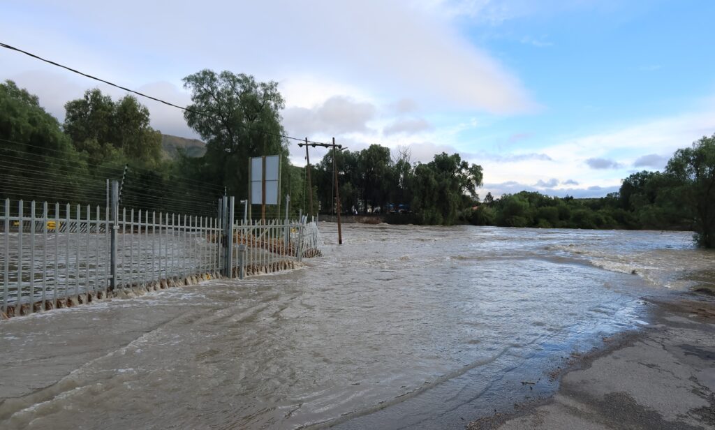
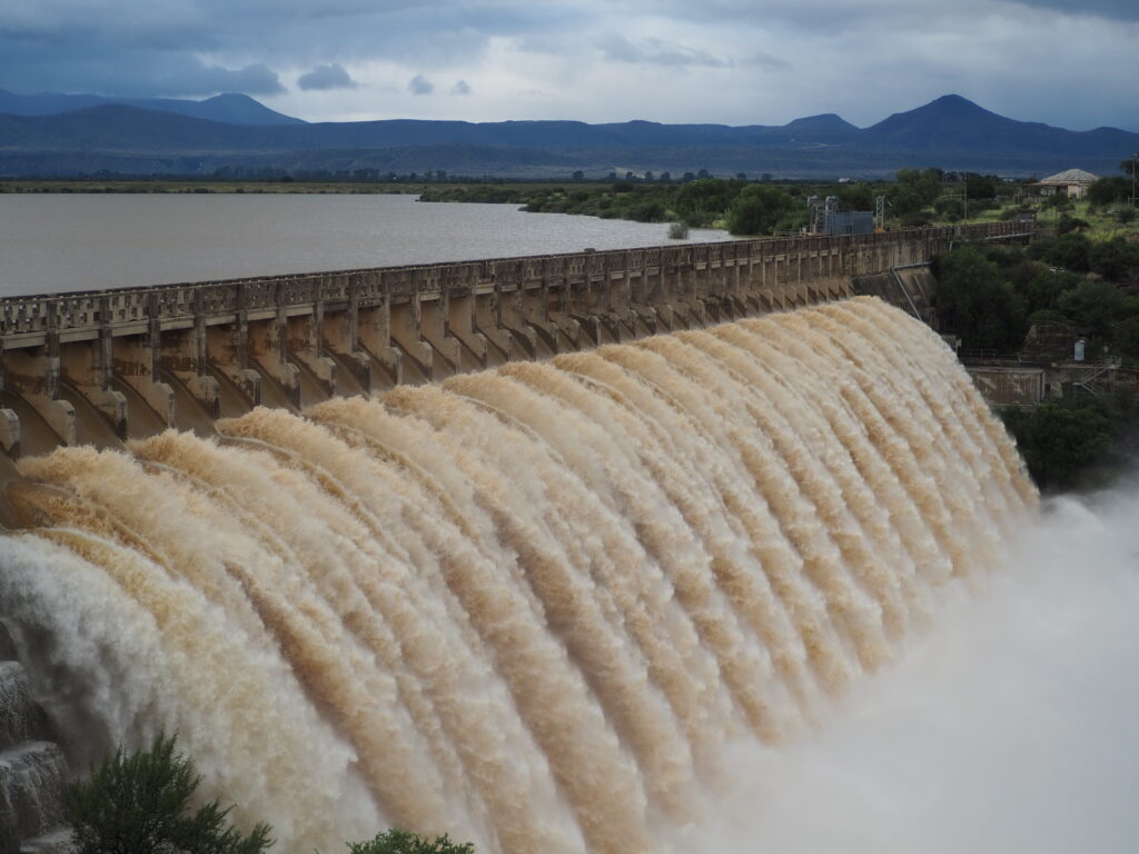
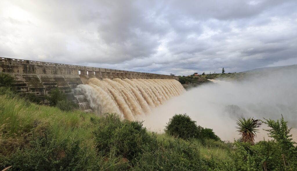
The Nqweba Dam reached overflow level after water levels increased rapidly from approximately 90.03% to 122.18% on Thursday, 7 May within a short period due to the continuous flow of water into the dam system. The Municipality further noted the severe weather warnings issued by the South African Weather Services(SAWS), with heavy rainfall experienced between 05 and 07 May. During this period, Graaff-Reinet recorded approximately 140mm of rainfall. Strong winds on Wednesday night rooted out trees in the area, damaging property and closing streets.
The Nqweba Dam (formerly Van Ryneveld’s Pass Dam) is a concrete gravity dam on the Sundays River within the Camdeboo National Park in Robert Sobukwe Town (Graaff-Reinet). Opened in 1925, the 1000-hectare dam supplies water to Graaff-Reinet and offers popular water sports, fishing, and birdwatching activities.
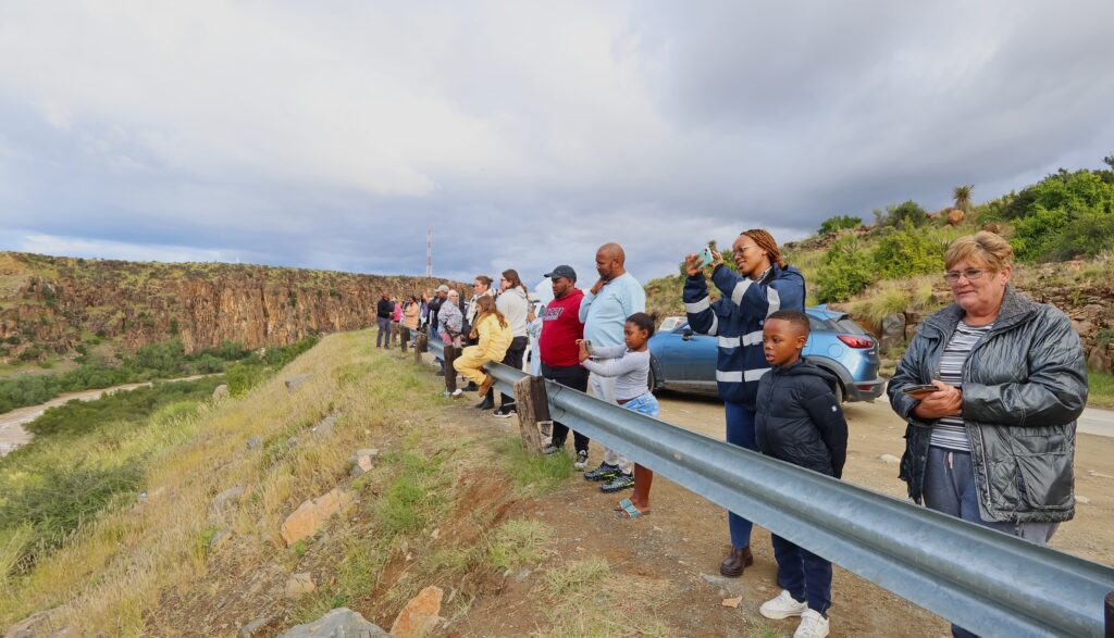
Since its completion in 1925, the Nqweba Dam has overflowed 8 times. Because the region is semi-arid, these overflows are rare and often celebrated as major community events.
Historical Overflow Timeline 1924/25:
Overflowed during construction just before the wall was finished.
January 1932: The first official overflow after the opening ceremony.1974: Caused devastating floods in Graaff-Reinet.
March 2008: Spilled for the first time in 22 years
February 2011: Reached 116% capacity—its highest level since 1974.
2012: Overflowed for several months on end.
June 2024: Overflowed for the first time in 12 years after heavy Karoo rains.
July 2024: High winds caused the water to surge over the spillway again shortly after the June event.
The dam has also dried up completely 9 times in its history, highlighting the extreme weather cycles of the Karoo.
Dr. Beyers Naudé Local Municipality wishes to inform the residents of Graaff-Reinet and all persons engaged in activities near the Nqweba dam and surroundings watercourses that the municipality remains on high alert following the recent persistent heavy rainfall across the area.
A notice issued by the Municipality is that the Sundays river is flowing at full capacity and this will possibly increase the water flow into the dam. In light of the above, the Municipality appeals to all residents and visitors to exercise extreme caution particularly in areas situated near:
- Rivers and streams
- >Low-lying bridges and crossings
- >Storm water channels
- >Water drainage routes
- >The Nqweba Dam and surrounding areas
Residents are strongly advised to: - >Avoid crossing flooded roads, drifts and bridges
- >Keep children away from rivers, canals and storm water channels
- >Refrain from fishing, swimming or conducting recreational activities near overflowing water bodies;
- >Remain vigilant and monitor official municipal communication channels for updates
- >Report any flooding, sewer spillages, damaged infrastructure or water-related emergencies immediately.
The Municipality remains on cautious alert and is closely monitoring all identified high-risk areas. Dam levels are currently being monitored hourly through the Municipality monitoring systems and relevant operational teams remain on standby to respond where necessary.
Emergency contact details residents may report water related emergencies and concerns to:
Municipal Call Centre (Office Hours): Emergency Contact: 049 807 5700 After hours: 078 151 4587


")
